
Organic Maps is an Estonian alternative to Google Maps and Waze for web search.
Last updated
- Headquarters
- Estonia
- Open source
- Yes
- Free plan
- Yes
Fast detailed offline maps with GPS navigation for travelers, hikers, and cyclists. No ads, no tracking, completely free with 100% offline functionality.
Community-driven open-source offline maps from OpenStreetMap data: no accounts, no ads, no tracking, light on battery and fast on old phones.
Organic Maps is an Estonian open source maps app with a single-minded focus: fast, private, offline navigation with no accounts, no ads, and no tracking. It is a community-driven fork built on OpenStreetMap, deliberately lightweight, so it runs smoothly on old phones and drains almost no battery.
The whole app works from offline vector maps, so hiking trails, cycling routes, and driving directions are available with the phone in airplane mode. There is no telemetry: the project states it collects nothing, and the Apache-licensed code is fully auditable. Bookmarks, track recording, and turn-by-turn voice guidance cover the essentials without bloat.
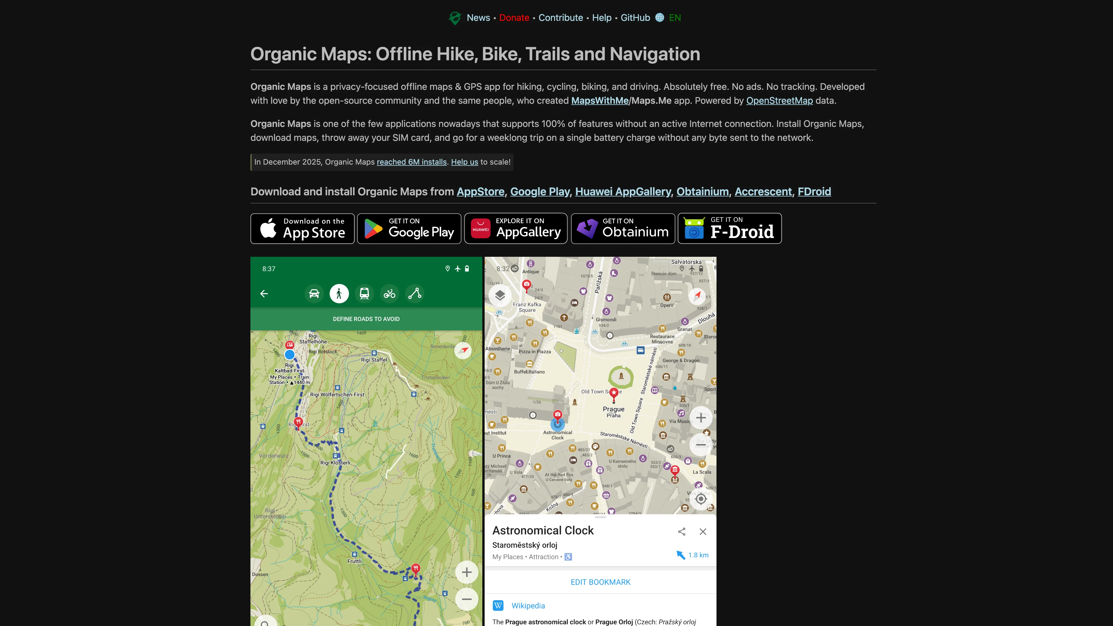
Key features:
- Fully offline maps, search, and navigation with no signal needed
- No tracking and no ads, with nothing sent off the device
- Lightweight and battery-friendly, fast even on older phones
- Hiking and cycling trails with contour lines and elevation
- Turn-by-turn guidance for driving, walking, and biking
- Open source under Apache 2.0, community governed
- Free with an optional donation to sustain the project
Organic Maps is developed by a foundation based in Tallinn, Estonia, by contributors who left a larger mapping app to build something privacy-first. It is the minimalist European answer to Google Maps for the outdoors.
Ideal for hikers, travelers, and privacy advocates who want a clean, offline, open source map without a US account behind it.
Categories
European alternative to
Head-to-head comparisons
See how Organic Maps stacks up side-by-side against the non-EU incumbent on jurisdiction, GDPR, pricing, and features.
Tags
Similar European alternatives

OsmAnd
Offline OpenStreetMap navigation with multi-profile routing, track recording, and terrain maps, open source and private with no tracking.

Magic Earth
Privacy-first navigation with turn-by-turn voice guidance, live traffic, offline OpenStreetMap data, and community hazard reports, collecting no personal data.

Qwant
Get fast, reliable answers with a search engine that doesn't store or sell your data. Hosted in Europe for enhanced privacy.

HERE WeGo
Navigate effortlessly with offline maps, turn-by-turn directions, and real-time traffic. Find optimal routes for car, public transport, cycling, or walking.

komoot
German outdoor route planner for hiking, cycling and running: sport-specific routing, offline maps and turn-by-turn navigation, with community highlights for trip inspiration.

HERE
Dutch-headquartered location platform supplying maps, routing and automotive-grade data covering 200+ countries, powering navigation, fleet management and automated driving.