4 Best European Mapbox Alternatives in 2026
The best European alternative to Mapbox in 2026 is Magic Earth, based in the Netherlands. All 4 options below are European-owned, GDPR-native and ranked by feature parity and relevance.
By the EU Alternatives team Last updated
Our top pick this year is Magic Earth, but every option on this list is European-owned, GDPR-native, and production-ready. Worth a closer look: HERE, Mapy.com, Jawg.
Mapbox alternatives are mainly Search & Internet. Browse that category for a wider shortlist beyond this list.
Top European Mapbox alternatives compared
| # | Alternative | Country | Open source | Free tier | Compare |
|---|---|---|---|---|---|
| 1 | Magic Earth | Netherlands | No | Yes | vs Mapbox → |
| 2 | HERE | Netherlands | No | No | vs Mapbox → |
| 3 | Mapy.com | Czech Republic | No | Yes | vs Mapbox → |
| 4 | Jawg | France | No | No | vs Mapbox → |
-
Privacy-first navigation with turn-by-turn voice guidance, live traffic, offline OpenStreetMap data, and community hazard reports, collecting no personal data.
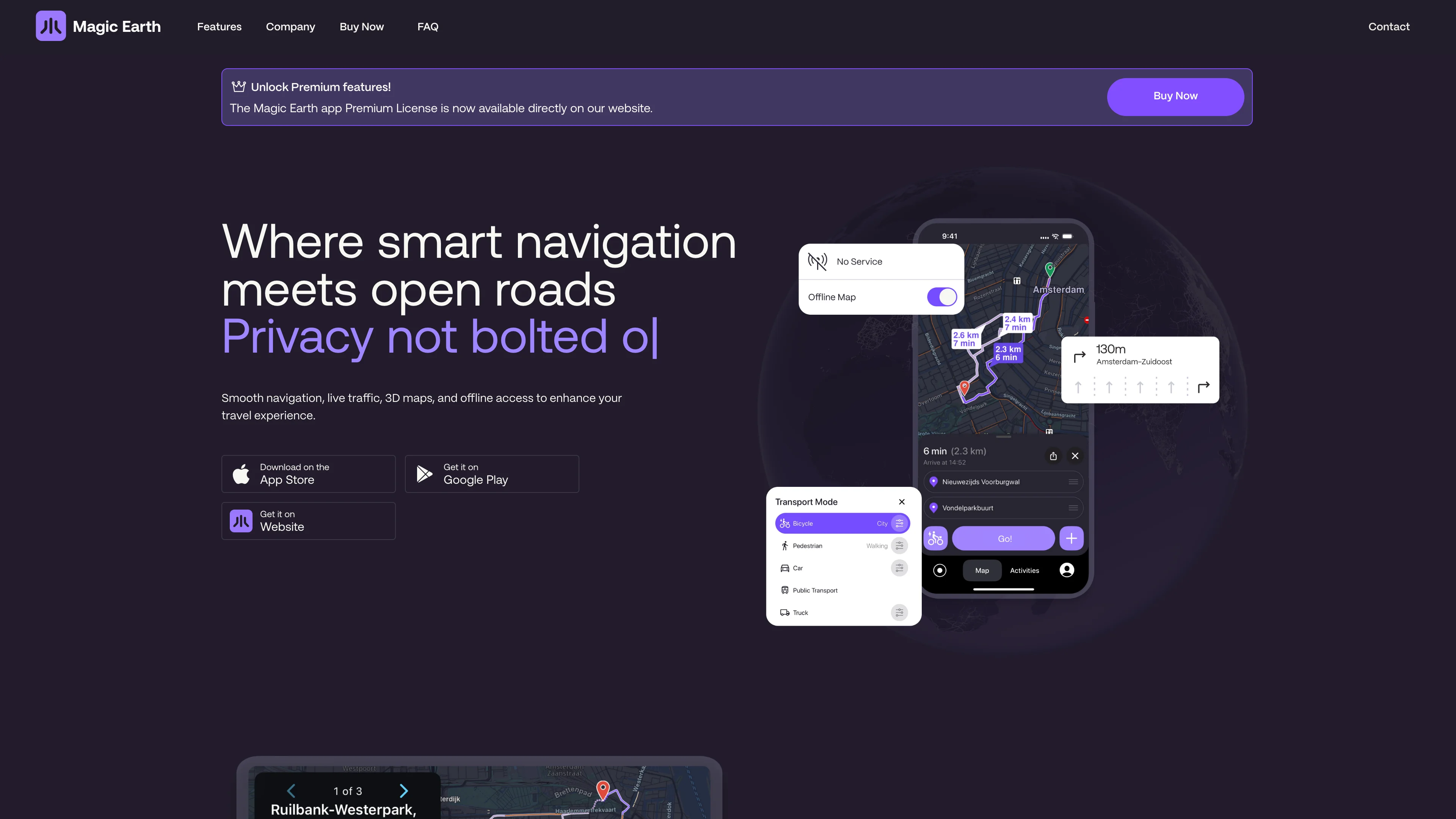
Magic Earth is a Dutch navigation app that turns the Waze value proposition inside out: full turn-by-turn guidance with live traffic, but with a privacy promise the US apps cannot make. The company states it plainly: it does not collect your personal data, does not track your movements, and has nothing to sell because it never holds your information in the first place.
Maps are built on OpenStreetMap, so coverage is community-maintained and works offline once downloaded. Routing handles car, bike, pedestrian, truck, and transit, with 3D maps, community hazard reports, destination weather, and Apple Watch support. Apple CarPlay and Android Auto integration make it a genuine daily driver.
Key features:
- Turn-by-turn voice navigation with live and crowd-sourced traffic
- No data collection, no tracking, and no profiling by design
- Offline OpenStreetMap data for navigation without a signal
- Multi-modal routing for car, bike, pedestrian, truck, and transit
- Community hazard reports flagging incidents and speed traps
- Apple CarPlay and Android Auto support on the go
- Free to download on iOS and Android
Magic Earth is developed by Magic Lane International B.V. in Amsterdam, Netherlands, with a heritage in mapping software stretching back three decades. A Premium subscription adds offline maps, activity recording, and CarPlay, but the core navigation and privacy stance are free.
Ideal for drivers leaving Waze or Google Maps who want real navigation without their trips becoming someone else's data.
-
HERE is a Dutch-headquartered location technology platform providing maps, routing, and automotive-grade location data to automakers, logistics operators, and enterprises. It powers navigation, fleet management, and automated driving with a unified live map covering more than 200 countries and territories.
The platform combines HD Live Map for road geometry, traffic signs, and route profiling with a cross-platform SDK, REST APIs, and tools for automated driving, digital cockpits, and anonymization of location data. Partnerships such as the SDV Accelerator with AWS extend HERE into software-defined vehicle architectures.
Key features:
- HD Live Map lane-level geometry for ADAS and autonomous driving
- HERE SDK iOS, Android, Flutter, and web development kits
- Global coverage maps and routing in 200+ countries
- Anonymizer privacy tooling for vehicle and sensor data
- Fleet and logistics APIs routing, matrix, and tolls for enterprise fleets
HERE is headquartered in Eindhoven, the Netherlands, and operates under EU jurisdiction with a published Privacy Charter and Responsible AI Charter. The platform emphasises data minimisation and GDPR compliance, and its Anonymizer tool is designed to strip personally identifying information from vehicle location streams before processing.
Ranked number one in the Omdia Location Platform Index and used by more than 90 OEM brands, HERE powers over 238 million shipped vehicles for customers including BMW, Mercedes-Benz, Audi, Ford, Bosch, Continental, SAP, Oracle, and Uber, offering a credible European alternative to Google Maps Platform for enterprise and automotive workloads.
-
Explore detailed world maps, find hiking and cycling trails, and plan routes for any journey. Offers comprehensive mapping for cities and towns globally.
Mapy.com makes outdoor route planning feel closer to reading a walking map than navigating a list of businesses. Its hiking and cycling cartography is the main attraction, with paths and terrain presented for people heading beyond city streets. The service also offers offline maps, useful when a planned trip takes a phone out of coverage.
The map portal dates to 1998, with its mobile application following in 2011. A logged-in account connects saved information and subscription features. Premium planning tools add activity-specific routes and personal walking or riding speeds, so estimated journey times can reflect the person making the trip. Offline downloads need advance preparation and enough storage on the device.
Key benefits:
- Outdoor cartography makes hiking and cycling routes easier to inspect before departure.
- Free offline country supplies downloadable maps for one chosen country, including regions.
- Premium offline maps remove the country limit for downloading maps before travel.
- Personal pace settings adapt Premium time estimates to individual walking or cycling speeds.
- Activity-specific planning adds Premium routes for running, gravel bikes and other activities.
- Saved route notes help Premium users record details and mark completed trips.
Mapy.com is operated by Seznam.cz, a.s., registered in Prague, Czech Republic. That places the operator in the EU, but the account and mapping service still process personal information. Its Czech origin should not be read as a promise of anonymous location use or an entirely open source application.
The free version allows one offline country at a time, which can be changed for a holiday. An annual Premium subscription expands that allowance and adds planning features. Frequent travellers get the most from the paid tier; occasional walkers can start with the free maps.
-
French mapping platform built on OpenStreetMap: map tiles, geocoding and routing APIs with custom styling, a European alternative to Google Maps for developers.


